Aerial Inspection
Our UAV platform is capable of performing a number of inspections for roofing, solar installation and HVAC units. Drones provide a huge advantage over traditional inspection. We are able to provide safe and accurate measurements through multiple data gathering points. Using aerial images eliminates time and costs for pre planning, assessing damage and estimating material costs. Inspecting roof details, weathering, leak assessment and drainage issues can all be done quickly and efficiently using our equipment.
For example, we can inspect a roof and provide angle, pitch, slope and surface area in a quick and efficient manner. This helps to eliminate unnecessary risk by keeping a person on the ground and in turn, decreases the time required to gather data, which leads to an increased ROI.
Looking to add solar panels to an existing surface? Our pre instillation flight data acquisition can provide roof measurements, assess quality of the structure and provide a layout for planning and site instillation.
benefits and deliverables
Image- Custom images to assess damage, count roof elements and pre-plan projects. Our aerial images are a great way to evaluate roofing needs to save time and increase efficiency throughout a project.
Aerial Video- Aerial video to assess overall roof quality. This is a great tool to use in solar instillation, showcase damage or for time-lapse video throughout a project.
Roof measurements- A PDF generated report to measure pitch, slope, area and square footage or commercial and residential projects. Data is gathered quickly and accurately using pre-planned flights to gather high quality images for measurements. Utilizing roof measurements saves time in planning projects and ordering materials, all while mitigating risk.
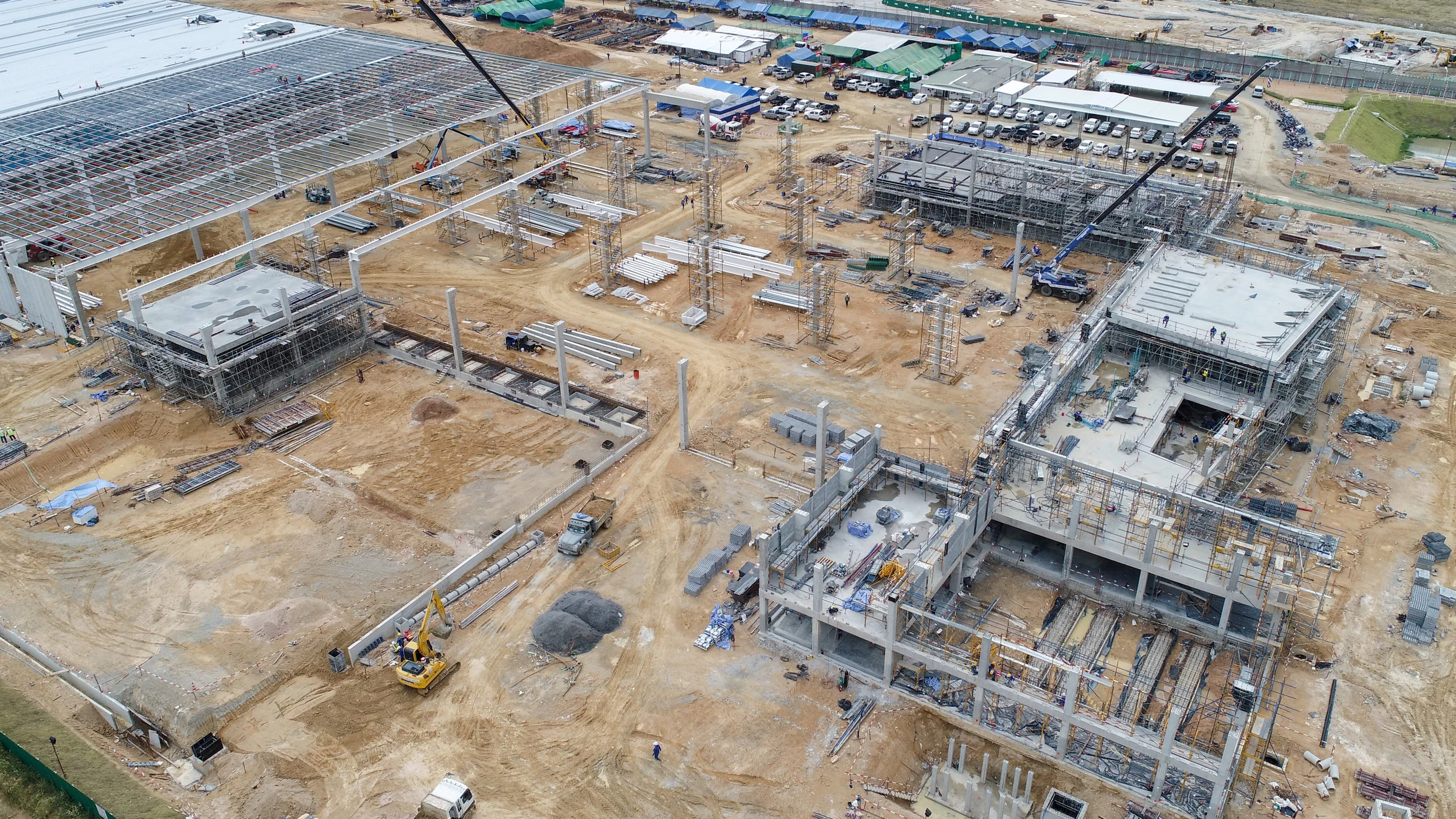
Orthomosaic maps- Pre-planned flights, gathering multiple images, to create a high quality, up to date map or your project. Custom maps provide insight for maintenance, HVAC locations, safety concerns and overall planning. This is a great way to capture data for larger projects and lengthy builds.

Orthomosaic location map

Solar panel installation- Measure roof dimensions and pre plan installation for accurate, timely results. .

Aerial roof measurements- Measure slope, distance, pitch and square ft with detailed accuracy.
*Maps are used as a tool to assemble reasonable data. Flytime Aerial does not interpret maps, define property lines for inspection or authenticate their accuracy. Lines are for reference only. The resolution per pixel will be defined in centimeters or inches, but will not be interpreted. This should be done by a licensed professional.*